

What does and Andean Breakfast consist of? It starts with a minimum of 1000m of steep climbing, toss in a good helping of hike-a-bike, add some gnarly cobblestones and/or deep mud, perhaps a dash of sand, some singletrack, and some of the most spectacular terrain and views found anywhere, then repeat. That’s pretty much how we would start our mornings for this 7 day, 500km, with countless meters of elevation gain bikepacking expedition across the high central Andean volcanoes of Ecuador.
I first found out about Chumba bikes while racing the TNGA in 2014 when I tied for first place “rookie” with Chumba Team Racer Joey Parent. We got along well and rode almost the entire race together and his URSA bike was ideal for the race. After that I knew I wanted to be a part of the Chumba community, but I moved to Ecuador a few days after the race, so I had to shelve the idea. So when Operations Manager Vince Colvin contacted me about organizing a multi-day bikepacking trip in Ecuador for Chumba Cycles USA; I jumped on the chance and joined the team.
Vince wanted to a ride that showcased some of the highlights of the central Andean volcanoes and featured as much singletrack as possible. Through stage races, talking with my local rider friends, and weekend-long bikepacking trips I was able to piece together an ideal route that would meet those criteria. I had done bits of pieces of proposed route that were spectacular, so as long as the rest of the route followed suit, I knew we would be in for a stellar experience. Vince also got in touch with the man, the myth, the legend Cass Gilbert of WhileOutRiding fame, and he was interested in joining the ride. He had just completed a crossing of the entire Ecuadorian Andes Divide, so he would be able to fill in the gaps of areas I hadn’t been to and take us through some sweet terrain. The route we finalized would take us to some of the most emblematic regions in Ecuador- Cotopaxi, Quilotoa, and Chimborazo, passing through some really remote highland (paramo) areas in between.
After bit more logistics and planning, Vince was in Ecuador with my new Chumba Stella XT plus the full suite of custom Chumba Bikepacking bags made by Wanderlust Gear. The poor guy had traveled with all of his equipment and an URSA XT in addition to my stuff-but I was grateful to have the sweet new rig to bring along for our crossing of the central Andean volcanoes.

Vince was also doing a family vacation down here, so instead of starting the ride from Quito (in my case) and Pifo (in Cass’ case), he would meet us in Cotpaxi National Park at the end of the first leg. This was a great decision since we woke up on Sunday morning to an absolute downpour. Even for Ecuador standards, this was incredibly heavy rain. It was so bad, several of my friends who were in Cotopaxi and Chimborazo contacted me to warn of flooding and miserable conditions. Cass and I tried to hold off on starting the ride until as late as possible, thinking it couldn’t rain this hard for more than a couple hours, but by 9am or so we knew we had to get going if we wanted to get to Tambopaxi before dark.
I reluctantly left my apartment in Quito, and despite my raingear, was soaked and freezing within minutes. From Quito, I began the ride with a 1000m (normally) blisteringly fast descent down to Tumbaco, but visibility was so limited that I had to go slow. From Tumbaco, I continued on pavement across the Valle los Chillos for a couple of hourse before finally turning off onto gravel and cobblestone on route to Pintag. Cass was staying near Pifo, so his ride to Pintag was a lot shorter and he had arrived in town before me and was already eating and drying himself out by the time I arrived, cold and hungry. I found a little grease pit street stall and filled myself with a greasy gut bomb that warmed me up considerably. While we were eating the rain finally subsided-which was fortunate. If it was this cold at 2500m, I didn’t want to think about riding for several more hours in the cold rain up to 4000m! After stocking up on Pintag’s famous sweet-cheese filled bread, we began the long climb up to the paramo on particularly nasty cobblestone roads.

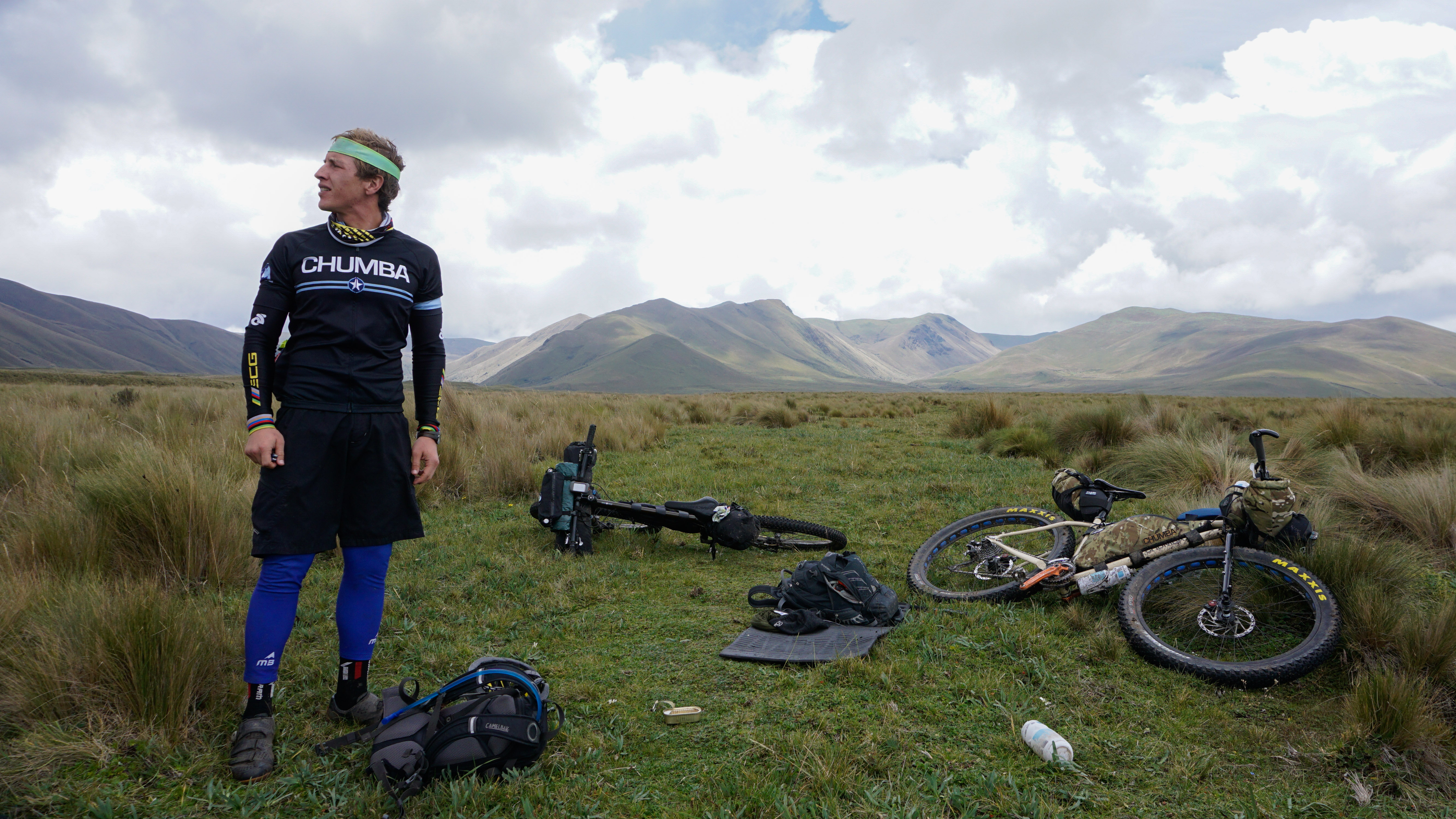
Although I’ve done a lot of bikepacking trips and races, I’ve always elected to go ultralight and fast, foregoing comfort for speed and distance. This trip would be different-we’d be taking 7 days to cover a distance I would normally cover in about 3 days going “race” style. So for this trip, I had packed substantially more gear, food, and clothing than usual, so my bike was far heavier than what I’m used to. Due to the extra weight, I was really suffering on the cobblestone climbs-my muscles just weren’t used to cranking so hard in the saddle. To add to the difficulty, Ecuador cobblestones really sap your speed and energy and bounce you around like a toy. I was definitely envious of the 29er+ which seemed to just eat the cobblestones up.
Fortunately, after a couple hours of climbing, the road turned to pretty gnarly jeep truck punctuated by huge, pond sized mud puddles-these difficulties actually broke up the monotony of the climb and made things more challenging and enjoyable, so I was able to forget my heavy load. We kept climbing and the landscape finally gave way to Ecuadorian paramo or northern South America alpine tundra ecosystem, which is a neotropical high mountain biome with a vegetation composed mainly of giant rosette plants, shrubs and grasses. Some biologists consider páramos to be evolutionary hot spots and among the fastest evolving regions on earth! Ecuador is packed full of superlatives such as this…As an ecologist and backcountry cyclist-its a veritable paradise for me. I absolutely love this stark, haunting landscape and try to get up to the paramo whenever possible.Once we were pedaling through the paramo, all memories of the mornings epic sufferfest began to fade and we just cruised along, taking in the scenery and feeling lucky the rain had stopped and we had a full week of this ahead of us!

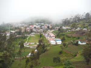
We arrived at Tambopaxi by late afternoon, making pretty good time overall. Vince was there, nice and dry, with his tarp already set up. Tambopaxi is a great little mountain refuge right at the base of Cotopaxi volcano. I had camped here several times for summit climbs while the Refugio at 4800m was being we reconstructed. The problem is that meals are incredibly expensive-$17 for lunch or dinner. That might sound reasonable for NYC, but in Ecuador, even in nice neighborhoods in Quito, you can get an awesome 3-course lunch for $2.50. Needless to say, we stuck with camp food-noodles and tuna for that night. While we were eating the clouds actually lifted a bit and Vince got his first views of the stunning, perfectly symmetrical, conical volcano. We went to bed that night under a waxing gibous moon reflecting off the glacier-this is the life!


Our plan for monday was to travel around the base of Cotopaxi volcano through some of the most spectacular volcanic paramo in Ecuador, so we didn’t plan to cover a lot of kilometers that day to allow plenty of time for photos and just to enjoy the peaceful, remote landscape. 
We also got in some really fun singletrack before hitting the boggy areas at the base of the infamous “El Morro” from the Vuelta al Cotopaxi stage race.
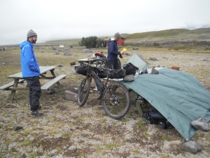
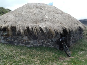
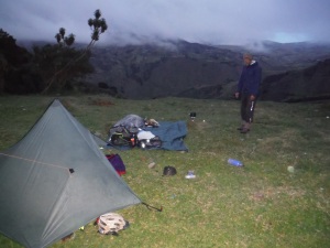
The last few kilometers of the day through deep mud and soggy grasses were pretty difficult, and we were above 3500m, so by the time we found a Inca shepard’s choza (the design of these thatched roof huts is incredible and remains largely unchanged after millennia of use-they shed water and stay dry and warm even in this cold, rainsoaked, humid environment). Unfortunately it was locked, but there was a cement storage building next door that we were able to use for the night. Not as warm as cozy as the choza, but better than sleeping out in the open paramo.

We knew we had a harder day ahead of us on Tuesday-starting with an Andean breakfast consisting of a burly hike-a-bike up to 4200m+ over El Morro, then another big climb before finally descending to the Panamericana Highway then another ascent towards Quilotoa before the day was done, so shortly after another noodle and tuna dinner, we turned in early and got a good night’s sleep.

After starting on some fun paramo style singletrack, the hike a bike over the Morro actually wasn’t that bad,. Near the top we saw two massive andean condors up close. What a way to start the day! We were then rewarded with an incredibly fact 20km descent down to a low valley. From there, we had a super steep, sandy climb up switchbacks to yet another pass, albeit a lower one than El Morro. From the pass, we had a fun descent on a mix of sandy double and single track. We were speeding our way down off the paramo when I looked up and noticed a small strand of barbed wire strung across the trail at neck level, and Cass was racing toward it at high speed. I called out when he was just a few meters from getting clotheslined, just as he himself noticed the wire, and he slammed on his brakes, coming to a stop just inches from the barbs. Whew, close call…
We cruised into Lasso, a small highway town along the Panamericana, had a $2 almuerzo (set lunch), stocked up on supplies and were on our way just as it began to drizzlem which fortunately didn’t materialize into a full blown storm. The first 12km up to Quilotoa were on paved roads, passing through Toacazo, the last real town we’d see until Zumbahua, past the Quilotoa crater. After Toacazo, we turned off onto cobblestone, which switched back to a very small paved road that climbed relentlessly back towards the paramo. We were taking a less common way to the Quilotoa crater, one that my Ecuadorian friends had recommended, saying it would eventually become singletrack.
It was getting very late in the day as we kept on ascending, passing a couple tiny hamlets and we needed to find a place to camp soon. After a while the road turned back to dirt and finally began to level off a bit as we passed through Yanaurco Grande just as a cold, steel gray fog enveloped us.


We filled up our water bottles as it started to get dark, and rolled out of the village feeling chilled to the bone, hoping we’d find a decent place for the night. It wasn’t looking promising since the terrain was steep all around and wherever it was semi-flat-there was always a small house or hut that was occupied, but fortunately we climbed back out of the fog again, so at least the weather was more pleasant. Just as it seemed we’d have to pedal into the night until we found something, we came through another tiny village with a church and small volley ball field. It would work as a campsite for the night, so we were pretty relieved. As we scouted around a bit, we found a great little grassy spot behind the church, right on the edge of a precipitous drop into the valley below-the view was stunning. At the very last moment, we had found a great place to camp!
As we were changing out of our riding clothes and making camp, we noticed several young village girls staring at us through the bushes-privacy would be an impossibility this evening so we embraced it and just smiled and waved as we continued to drop trow. We were probably the most interesting thing to happen in this village in a long while, so why not. We had a pleasant evening cooking in the bright moonlight looking down into the deep valley below, and turned in for the night just as the fog and drizzle moved in on us again.
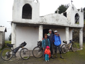
I guess word of the gringo squatters had made it around town that night, so in the morning we had even more onlookers as we broke camp. A village elder came down and actually talked to us, snapping photos of us with his cell phone! Just before leaving, he insisted on getting some pics of us all together, which we enthusiastically agreed to. You have to admire the hospitality of the indigenous communidad Andino in Ecuador. I shudder when I think of the welcome you would get if you tried to camp behind a church in the middle of a town in the USA! In Texas, where Vince hails from, they would probably shoot first and ask questions later. Here, they welcome you and want pictures taken of you with their children!
We started the day with another Andean breakfast, a nearly 1000m climb to a high pass at 4200m. But the climb was on a decent dirt track and graded well for Ecuador standards, so it was quite pleasant. One thing I love about the Quilotoa region is that its full of local communities who live largely like their Inca ancestors, herding animals and growing Andean crops such as quinoa, potatoes, and habbas. You pass one small farm after another clinging to the steep Andean slopes, smiling children waving you on and little old ladies carrying massive loads and shepherding sheep and llamas while rolling through this ancient mountain landscape.

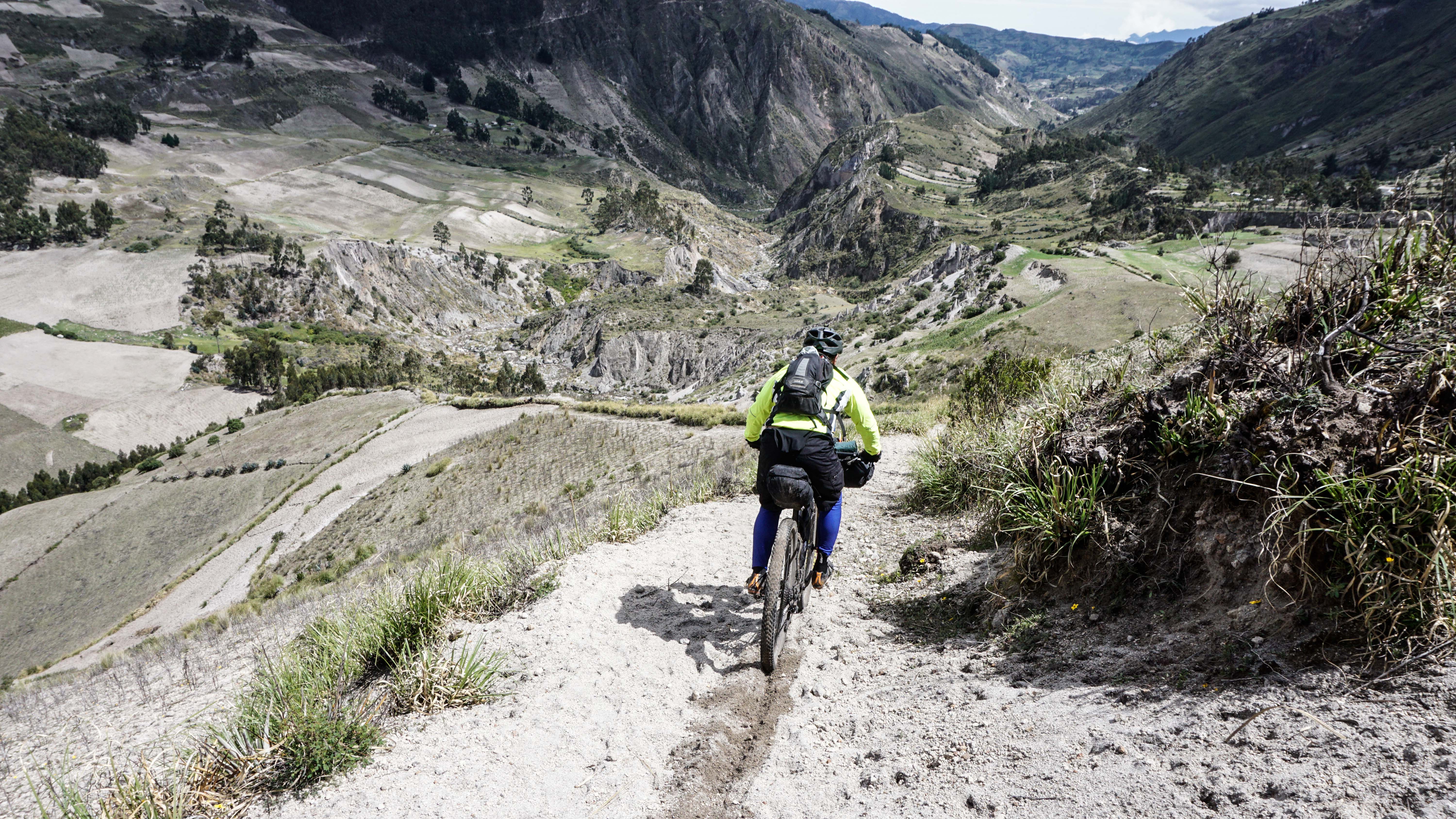
After the pass, we started dropping down into the massive canyon that separated us from Quilotoa. We began on dirt road, which gave way to burly jeep track, and finally lead us to the edge of huge precipice-where we could get a good look at the epic singletrack below. There was a small village school right on the edge of the cliffs that excitedly came to watch us descend on our fully loaded bikes. The singletrack dropping several hundred meters to the river below is impossibly steep, sandy, and puncuated with rocky sections and deep ditch washouts. It would have been hard to ride clean on a downhill bike, much less on fully loaded bikepacking set-ups-but we gave it our all and cleaned what we could-hootin and hollerin all the way down.


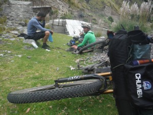
The last part of the “trail” leading to the river was pretty much unrideable, so we walked out bike’s down and had some food at the river’s edge before tackling the nearly 2000m to the top of the Quilotoa crater.
We had anticipated a long hike a bike out of the canyon, but were stoked to find a decent dirt road, so the climb went rather quickly up to Quilotoaloma, a small Andean community on the backside of the crater. From there we had the option of continuing up the nice dirt road to the Quilotoa village, or taking a more direct, but infinitely harder hike a bike/bushwhack up the crater, then push or ride our bikes halfway around the crater ridge on the hiking trail. Naturally we chose the latter option.


The first part was hard and required pushing or carrying the bikes, but was at least on trail. Eventually the trail completly petered out and we had to bushwhack, push, pull, lift, and drop our bikes as we grunted our way over small knife edge ridges and through inpenetrable thorny bushes for a couple of hours until we finally made it Enshalala- an ecotourism lodge built and managed by the local Quilotoaloma community whose members we had met below. I highly recommend staying here if you are in the area-its a beautiful area with a cool overlook and lodge is really well done-plus you’ll be supporting this remote community. From Enshalala- we carrying our bikes up the steps to the stunning overlook of the Quilotoa crater lake and hung out for a while to recover from the hike a bike and snap some pics.


From the overlook, it was another 30 minutes of steep bike pushing up to a high point on the ridge before dropping back down into Quilotoa village and lunch! The pushing up the ridege was hard, but the singletrack on the other side was epic! Cass got some awesome pics of this section-check it out: https://instagram.com/p/1KKRo4P_mZ/.
After Enshalala and the rugged terrain around the crater, the touristy overlook at Quilotoa village didn’t seem too appealing, so after slightly overpriced and underportioned meal in town, we decided to head straight down to Zumbahua.

We stopped at the first bakery we saw in Zumbahua and raged several pan de chocolates (chocolate bread)-a bike tour favorite all over Ecuador. It was getting late at this point and we had a nearly 1000m climb on a big paved road ahead of us, with limited options for camping so we opted to stay in Zumbahua that night rather than camp. It was a good opportunity to dry out our stuff, get some good food, and restock on supplies. We found an $8 a night shabby hostal, dropped our bikes and went back out in search of more food. Cass and I braved some street meat (not sure if it was chicken or pork-but damn it was good!), but Vince opted out. I’m glad we ate it since it was the only decent food we found in town. Later that night we ate in our hotel and it was one of the worst meals I’ve had in Ecuador, only breakfast the next morning at the same hotel being even worse!!


After a rather loud nights sleep, we got up early, forced down the unappetizing hostal breakfast, and began the Andean breakfast climb up to the high paramo around 4200m. Since the road was paved, we climbed rather quickly. Vince was still tired from the hike a bike the day before and he was less acclimated than Cass and I, so we sped ahead and waited for him at the top of the pass, where we turned off onto a dirt road. We found a nice place to sit and wait with stunning views of Zumbuahua way down below, figuring Vince would see us as he passed by.


After half an hour or so, we saw Vince cruising up the highway and yelled out to him. He looked over at us, so we assumed he saw us and would be coming along shortly. I guess it was just coincidence that he looked our way just as we yelled, since he ended up riding right past us up to the top of the pass on the highway, rather than turning off. When he didn’t show up, I was was kind of freaked out, thinking he might drop down the other side which would have lead him several thousand meters down to the coast. I hopped on my bike and tried to follow him up the pass, and just as I crested the top, I saw Vince heading back down towards me. Whew-I was stoked he didn’t drop to the coast-that would have cost us at least a day.

Shortly after we got back on track and began trekking across paramo on rolling dirt roads looking down on the cloud forest below, with the occasional glimpse of the coastal banana plantations thousands of meters below. This is one of my favorite paramo areas in Ecuador-the hillsides are dotted with choza that people still inhabit, rather than the cement buildings many of the shepherd families have more recently begun to opt for. It has a remote feel to it, bordered on one side by high steep mountains with the precipitous drop into the cloud forest on the other side. Cass stopped to take a picture of a some shepherds with their flocks with a great views in the background, when his wide angled lense must have rolled out of his bag. Vince and I were a ways ahead before we noticed Cass wasn’t with us- apparently he had noticed his missing lense and ridden back to find it-but we didn’t know it at the time. We waited for half an hour or so before heading back to look for him. We hoped nothing bad had happened. Shortly after, a truck passed by and relayed a message from Cass, telling us what had happened and to head on to Angamarca, the next village on the route. We hoped he’d find the lense soon and heeded his advice, continuing on our way. Less than half and hour later, another truck passed by and handed us the wide angled lense, having spotted it on the road! Yet again, I was completely taken aback by the honesty and kindness of these people. The lense is probably worth more than they make in a year, yet they handed it off to the crazy gringos on the bikes rather than taking it to the nearest city to sell it. #restoredFaithinHumanity!


We were stoked to have it but they hadn’t seen Cass so we knew he’d still be looking for it. We decided that rather than turn back, we should send him a message with the next passing vehicle. We didn’t see another for a long while, but finally a guy on a motorcycle passed by and we begged him to let Cass know we had the lense. From there we took our time getting to Angamarca, stopping to take pics on some singletrack sections and enjoying the day, finally making progress and hoping Cass was on his way. It wasn’t too long after that Cass caught up with us. The motorcycle guy had relayed the message, but Cass couldn’t believe it-we could hardly believe what happened ourselves. From there we had a “small” (1500ft+) climb to another pass before the big drop down to Angamarca, one of our lowest points on the ride. The weather at the bottom was sunny and beautiful until we made it to the pass where the fog rolled in. I was a bit ahead at this point and hung out at this creepy little church with a medieval red door.

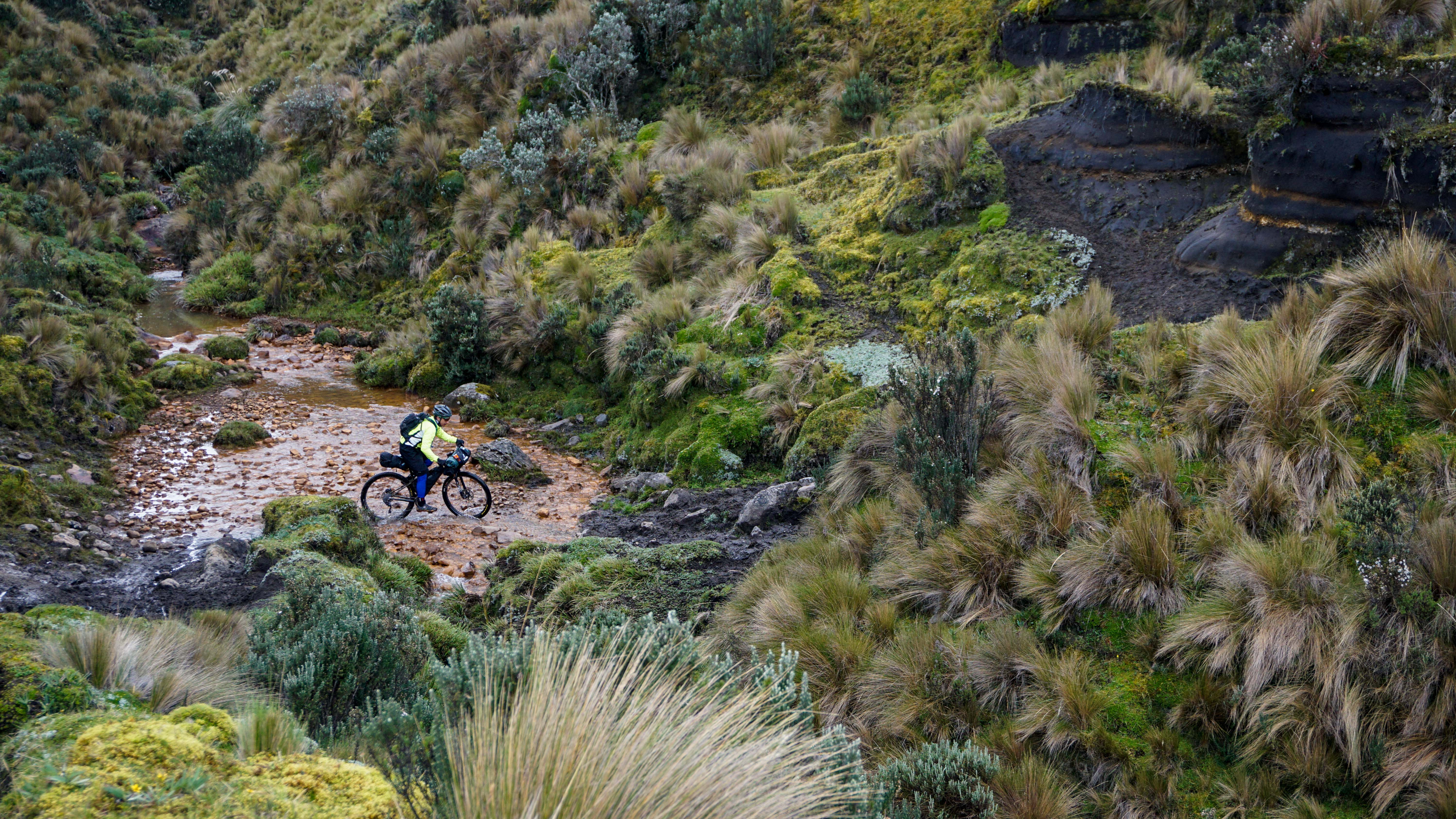
From there we had a huge descent down to the edge of the cloud forest. We found some sweet, though muddy singletrack during the descent to spice things up.


After descending through the fog, we finally caught a glimpse of Angamarca and made our way down to town. I really like this town, it just has such a remote feel and the people are super friendly. Right in the central plaza of town a woman was cooking some fantastic tortillas de papas with eggs for $1. It hit the spot after a long day, so much so that we all had a second plate. Probably not the best idea considering we had a 1500m+ climb ahead of us, but we hadn’t eaten anything so tasty in several days, so it was worth the discomfort later on.

After lunch, we stocked up on the limited food supplies available town, and got on our way just as thick fog rolled in which quickly changed over to fairly heavy rain. We ducked under a small shelter, hoping the rain would pass, but after a while we knew we had to start the big climb, rain or shine. Fortunately, the rain tapered not long after we began the climb, which was good, because the climb turned out to be one of the harder ones of the trip. It started with steep switchbacks on loose gravel and dirt, but as we got higher it turned into a thick muddy slop with the consistency of peanut butter, so for the next few hours we slipped and slid our way up to the paramo. In Ecuador, you either quickly learn to find your zen place on such climbs or you stay at home, so we put our heads down and happily grunted our way up the mountain. As we climbed above the foggy cloud forest and finally reached the paramo, we were rewarded with a beautiful rainbow arcing over the peaks as the skies began to clear.

I reached the top of the pass ahead of the guys and was stoked to find a very basic little community store in the tiny hamlet on this cold windswept section of paramo. The wind was bitingly cold up there so I braved the snapping dogs and made my way into the store, happy to be out of the wind while I waited for the guys. The owner was very friendly and talkative for high Andean standards and I quickly bought up half of his stock of chifles (fried plaintain chips that are ubiquitous in Ecuador) and a soda. Cass arrived shortly after and we asked the owner the name of his dog, which turned out to be “Twitter,” because the dog serves as a sort of messaging system across the high valley through its incessant, loud barking. Maybe it was the altitude or the setting but I found this to be hilarious at the time. Although this “village” probably won’t have internet connections for another 20 years at the earliest (they’ll need electricity for starters!), somehow the locals knew about Twitter. Its nearly impossible to truly get away from the internet and global communication these days-for better or worse. Still, I found it amazing.
Vince arrived a little while later and had thoroughly enjoyed the climb to the paramo having met some really friendly locals on the trail and still stoked about the rainbow. It was quickly getting dark by this point, so we boogied down the other side to look for a place to camp for the night and escape the icy winds on the pass. Not even 10 minutes later, just as the last rays of light dropped below the horizon, we came upon a small school house with an unfinished concrete building that would make for a great home for the night. Continuing the tradition of noodles and tuna which is the only meal you can consistently buy at the small shops in the small highland villages, we had our dinner and turned in for the night under the brilliant, now full, moon. It had been an incredibly long, eventful day but couldn’t have ended better.
We woke up to stunning views of the steep Andean slope leading to the cloud forest thousands of meters below, and after a power breakfast of oats, raisins, and machica-we were on our way. This was the first morning of the trip where we didn’t start with a non-stop 1000m+ climb, instead we rode up short steep hills followed by exhilarating descents, one after the other, as we contoured along the edge of the paramo and ticked away the morning hours in great spirits. Just before lunch time we finally made to our first major climb of the day which would lead us up to our highest point of the trip to that point, about 4300m. We had been on fun jeep track all morning, but for the climb we turned onto a better dirt road so the climb, though steep, went quickly until we gained the ridge and were buffeted by strong icy headwinds. Cass and I battled our way along the ridge to the highpoint marked by a cross, and decided we better hunker down as we had gotten ahead of Vince.

Fortunately we found a little dirt cornice that we could huddle under to escape the wind, but when Vince arrived, I was chilled to the bone and ready to get off the pass. Unfortunately, rather than a fun descent, we lost several thousand feet of elevation on nasty cobblestones, the bain of Ecuador backcountry roads. After a few kilometers I couldn’t feel my fingers on the brakes and it became hard to grip the handlebars in the icy cold with the nonstop teeth-rattling cobblestones, but finally we found some smooth dirt singletrack and had an epic descent for the last couple thousand feet into the valleys around the mighty Chimborazo. Chimbo (6268m) is the highest peak in Ecuador and due to its proximity to the equator (the earth bulges at the equator and pinches down at the poles), is actually the highest point on earth relative to the earth’s core, or put another way, its summit is the closest point to the sun on earth.


But Chimbo is perhaps even better known for the world renowned “Bar Internacional Don Max (pictured below),” the most hoppin bar this side of the paramo.

Cass had passed by this landmark several years before and I had been looking forward to seeing this place. I still can’t get over the name or location of this “bar.” Its literally just an old dumpster and shipping crates in the middle of nowhere that Don Max has converted in the only bar for miles in any direction. I was crushed to see that it was closed, but even so, there were two young ladies waiting to get into da club.

From Don Max’s, we headed down the road a bit and passed by some hot springs. It was a holiday weekend so the baths were hoppin, and fortunately there were some food stalls catering to the bathers. Conditions were far less than sanitary, with dogs everywhere and buckets of fish heads and guts next to the wooden bench seating area, but we were starving and it was a chance to get some hearty eats. The stall was serving fanesca, a soup consisting of 7 types of beans and grains along with fish chunks and some other veggies. Its incredibly hardy, but an absolute gut bomb. It was damn tasty though, so we each had 3 bowls followed by a delicious sweet squash drink that was served piping hot. I was bursting at the seams by the time we were finished, and of course we had to climb all the way back up to 4300m that day, so we would pretty much be climbing nonstop for the rest of the day.

At the first hike-a-bike up an impossibly steep hill, I immediately regretted the 3rd bowl of fanesca, but the scenery was beautiful and we were following a neat, off-trail route up to the paramo, weaving our way through tussock grass and following small irrigation ditches that led down to the farms in the valleys below. After a hard, but fun, few hours, we reached the paramo again, and cut out of the tussock grass bushwhacking and onto a dirt road as we approached the Chimborazo Reserva de Producción Faunística. As we entered the reserve, the sun began to burn through the clouds and we started to get glimpses of the glaciers of Chimborazo volcano. Not long after, we came upon several heards of vicuñas, which are native, wild camelids, similar to alpacas, their domesticated cousins. Their wool is world renowned as some of the finest on the planet. The herds in Ecuador were actually hunted to extinction many years ago, but recently they transplanted a population from Chile that is now thriving in the reserve. Back in my mountain guide days in northern Chile, we would see hundreds of vicuñas everyday, but seeing them never gets old, especially in such a majestic setting.


Vince was stoked to see his first vicuñas, but was still struggling with the heaping bowls of fanesca. I couldn’t resist snapping a shot of him in his misery!
Once we entered the reserve, it was just a short, gradual climb up to the base of the pass that separates Chimborazo and its neighboring peak Carihuairazo (5018m)(which might be the hardest word ever to pronounce). The indigenous community in the area runs a small mountain refugio, which we didn’t want to stay in, but fortunately there was an amazing choza right next to it, and we decided to spend the night there so we could spend the remaining hours of daylight enjoying the amazing views of Chimborazo.


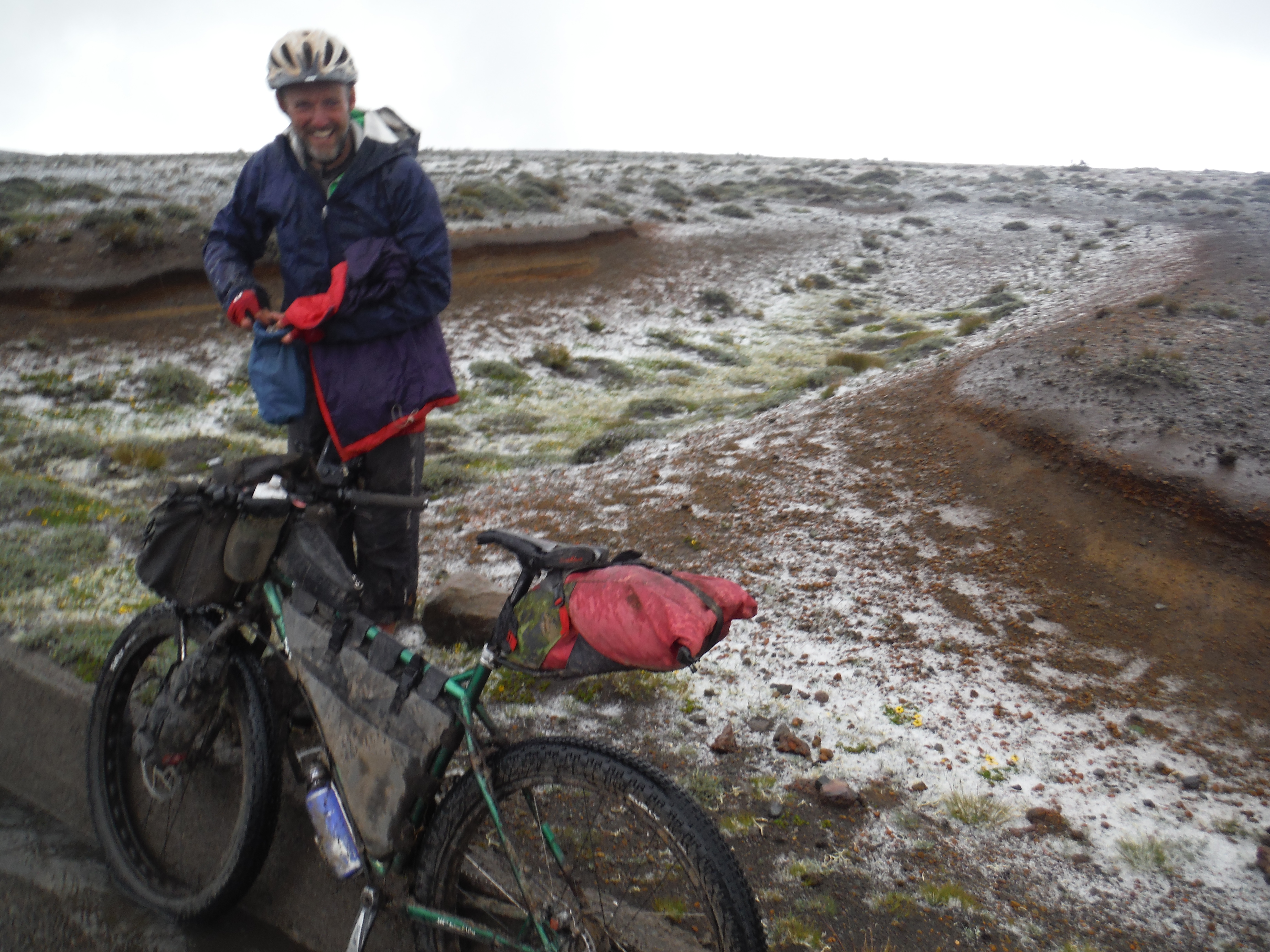
In one of those “small world” type coincidences, I ended up knowing the guide, Fabian, who was staying at the adjacent refugio, having met him during a climb of Cotopaxi a couple months before. We chatted for a while and it turned out he knows my colleague Deb, a world renowned alpine stream ecologist, who has some study streams on Chimborazo. It also turned out that I had a mutual acquaintances with two of his Spanish clients, a fish biologist that lives in Quito. We were all so stoked to be rewarded with such stunning views of the peak. I’ve been to Chimborazo several times and had never had such good views. As the sun went down, it got bitingly cold and we were glad to be staying in the well insulated thatch choza. After dinner, I went outside of the choza to take a leak and was floored by the view of Chimborazo basking in glow of the nearly full moon. I ran back in and told Vince he had to get some pics. He was tired and ready for bed, but suited up and went out with his tripod and got this epic shot.

The view was so amazing that its impossibly to do it justice in 2D, but this pic comes damn close! Nice work man. We woke up the next morning and climbed the couple hundred remaining meters up to the pass that splits the two peaks at 4400m. From there we had a huge descent on singletrack that started out as great fun, but quickly turned into a deep muddy bog. Even though we were descending, the mud and standing water was so deep, we ended up having to trudge through a good part of this descent rather than ride. The guys on the fatbikes definitely had an easier time of it through the slop; they seemed to be enjoying it while I was struggling and walking! After a few river crossings and some steep muddy hike a bikes, we finally made it to a dirt track, and from there it was smooth sailing down to Urbina, where Vince would split off to the Panamerican highway while Cass and I would continue up and over the highest pass of the trip at 4500m then drop way down to Salinas, a small town on the edge of the cloud forest.


Kudos to Vince for an epic ride-what an effort to come directly from Texas and then ride for 5 days mostly above 12,000ft and with passes over 14,000ft through such challenging terrain! After splitting off from Vince, we contoured around the base of the mountain on cobblestone roads until we came to Cuatro Esquinas where there was a small store, and we stocked up on bread and crackers.

From there we climbed up a brutally steep dirt track that is part of the Chimborazo Extremo race. In fact, we later found out that nearly all of the route we did from Urbina to the main entrance to the Reserve was part of the race course. The only difference was that we were carrying an extra 20+ lbs of gear and had been riding all morning before getting on the course.
After the dirt climb we hit a paved road, which we followed for a while but split off on dirt roads and singletrack every few km. As we were heading up one of the paved sections, I saw two riders blazing down from the pass. They both had blue helmets and looked eerily like my two great friends Pericles and Gaby, whom I ride with several days a week in Quito and surrounds. As they got closer I realized it was indeed Peri and Gaby and I called them over. It was so weird to see two close friends so far from home after 7 days of nonstop backcountry bikepacking. After chatting for a while, we all still had a lot of ground to cover that day, so after snapping some group pics, we continued up the mountain and they sped down it.


After leaving Gaby and Peri, we got on some really fun single and double track climbs that led us all the way up to the main Reserve entrance, just before the high pass at 4500m. At the entrance, I quickly walked through the little visitors museum while Cass asked the guards if there was a way to continue on trail and avoid the paved road.


From there, we continued on old dirt roads and trails up to the pass.
As we crested the pass, it became completely socked in with fog, limiting visibility to a few feet and making it impossible to follow the track, so we had to drop down to the pavement, just as the clouds began to burst.We dropped down off the pass in the thick fog and rain, hoping drivers would reduce their speed in these conditions and not hit us. On the other side of the pass, the rain turned to a snowy slushy mix, which froze and soaked us to the bone. At highway crossing, we ducked into a derelect building that apparently is used as an outhouse by highway travelers-it was a true cesspit-but it got us out of the snow for a bit. We waited about 20 minutes, but just kept getting colder and we still had a long way to go to Salinas, so we reluctantly stepped back out into the wintry mix that was still coming down in buckets. One thing you can count on in the highlands of Ecuador is variable weather, and fortunately the snow/slush let up after a short while and turned to light drizzle. It had been a while since I could feel my fingers and toes, and was soaked and cold to the core, so it was a relief when it stopped snowing, especially since we were close to the top of yet another pass which would be followed by a long, cold, muddy descent down to Salinas.
We dropped several thousand feet down to the tiny hamlet of Pachancho Central and I arrived cold and shivering. Cass is more prone to overheating than getting cold and he seemed to faring much better than me. After Pachancho, we turned off of the dirt road onto an epic 12km descent on singletrack that led straight into the central plaza of Salinas. Due to the heavy rain, the singletrack had morphed into a small river, punctuated by deep mudholes, so it was incredibly challenging. At least it took some effort so I began to warm up. As I approached town my bike and I were nearly completely covered in mud when I came upon mud-puddle the size of a small lake. I tried to avoid it by traversing across a small muddy ledge above the mudhole, but the ledge crumbled and my bike and I went into the mud, reaching up to my handlebars and causing my GPS to shutdown! I was worried I had lost the entire track from our trip. Huge bummer! (I was later able to recover the files-whew!) From there, I cruised into town looking like some sort of swamp beast and waited for Cass in the plaza.

He arrived a few minutes later and we found a sweet hotel for $10 a night, with a wood burning stove so we could dry out our things a bit. I felt bad tracking in several kilos of mud, but it was unavoidable. Seven days and 500km of paramo after leaving Quito, we had arrived in our destination and could relax. If you find yourself doing a big bike trip in Ecuador, make sure you pass through or finish your route in Salinas (the remote highland one 35km north of Guaranda, not the beach resort town!)-what an amazing little town.


Apparently, in the 1970´s, Salinas was one of the poorest towns in the country, consisting of little more than a church and some thatch roofed chozas, when an Italian missionary named Antonio Polo rode into town and completely transformed the place by setting up a credit cooperative to buy cheese and chocolate making equipment. Under expert Swiss guidance, they set up world class cheese and chocolate factories and now export very high quality products all over the world. This has benefited the town inmeasurably, and when coupled with the towns beautiful location high up in the Central Andes, has turned into somewhat of tourist destination, mostly for local tourists. That night we sampled some of the local fare at a pizzeria run by an Italian-it was the best pizza I’ve had in Ecuador. I guess he couldn’t beleive we each ate our own medium pizzas (which were admittedly large for one person, but we had earned it), so he gave us each a free shot of some local spirit that burned like crazy but had a good flavor. What a town!
The next morning, after stocking up on incredibly cheap organic dark chocolate and nibs, Cass and I said our goodbyes and I took a pick up truck taxi down to Guaranda and from there caught a bus (unfortunately with no spare seats) for the 5 hour ride back to Quito. What a stellar route through spectacular country with great company. I highly recommend this route for the intrepid bikepacker, or with some slight variations that avoid the trails and hike-a-bikes and keep you on the dirt roads, the route could be doable on a touring set up with mtb tires.

Alex!! Love your Ecuadorian bike adventures. We’re here in Colombia right now riding our bikes. I’m wondering if you can send some GPX files of your route along the paramos of Ecuador? Please send it to dean_cunanan at yahoo dot com. I’ll be a big help.
Thanks,
Dean
Shoot, sorry I just saw this! Do you still need a GPX? I probably have one somewhere…
Alex,
if you don’t mind, you can send it still. We’re still here in Manizales. We just rode in Los Nevados. It’ll be nice if you can still send the tracks. Haven’t really planned Ecuador yet so it’ll be a big help.
Dean
Twenty years from now, you will be more disappointed by the things you didn’t do than by the things you did. Explore. Dream. Discover. – Mark Twain
>